NEWS |
_____________________________________________________________________________ GeoNeurale NEWSLETTER SUBSCRIBE FOR THE MONTHLY GeoNeurale NEWSLETTER just send your email address at NEWS@GeoNeurale.com _____________________________________________________________________________ AMONG OUR CLIENTS :
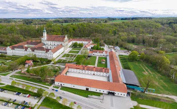
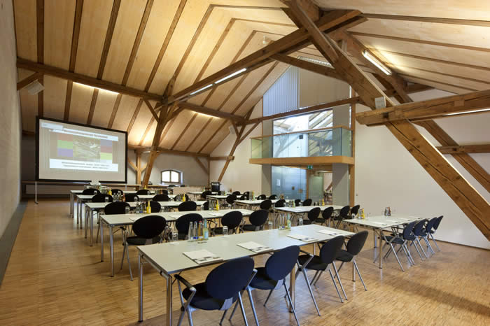
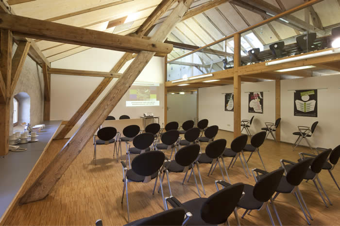
Maerskoil, PGS, Wintershall, GGA, GAZdeFRANCE, Geofizyka-Torun, Total, Schlumberger, Hurricane Exploration, Cairn India _____________________________________________________________________________ GeoNeurale moved its training activity to the Conference Center - Forum Fuerstenfeld
The conference center
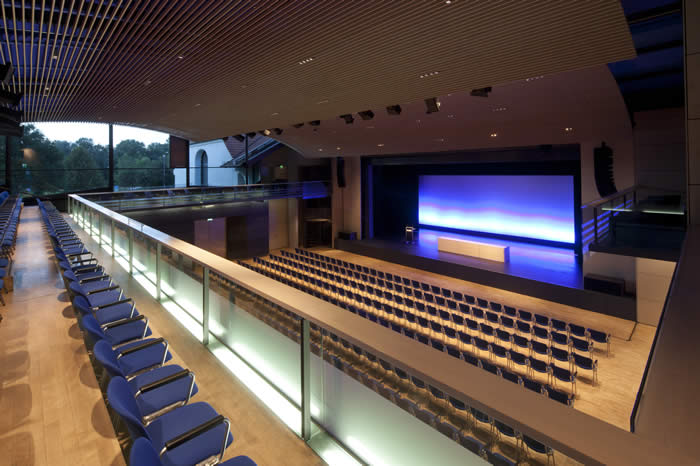
Raum S1 for GeoNeurale training courses
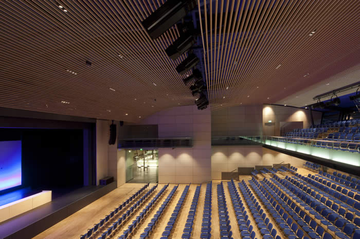
Raum S5 for GeoNeurale training courses
_____________________________________________________________________________
GeoNeurale is hosting the 2018 SEG DISC with Kurt Marfurt Seismic Attributes as the Framework for Data Integration throughout the Oilfield Life Cycle 01 June 2018 _____________________________________________________________________________
GeoNeurale Wavefields
_____________________________________________________________________________
DDS_1 THE NEXT GENERATION OF GEOTHERMAL PROJECTS
_____________________________________________________________________________
SEISMIC VOLUME PETROPHYSICS GeoNeurale Research announces new developments on new methods for the Inversion on Petrophysical and Rock-Physical properties on the 3D seismic volume. More informations: info@GeoNeurale.com
______________________________________
DDS - " DEEP DIRECTIVITY SYSTEMS " A TECHNOLOGICAL INNOVATION WHICH CHANGES THE FUTURE OF GEOTHERMAL ENERGY PRODUCTION AND ENABLES NOVEL EFFICIENT APPLICATIONS USING OIL AND GAS EXPLORATION AND PRODUCTION TECHNOLOGY IN GEOTHERMAL ENERGY DEVELOPMENT. _________________________________________________________________________________________________________________
OPPTIMAL : FRACTURE DETECTION TECHNOLOGY A new method fro the reservoir characterization of fractured reservoirs
ASTO GEOPHYSICAL Borehole Seismic Modeling and Procesing _________________________________________________________________________________________________________________
The Oil Exploration Industry needs more Intellectual Workforce
With the catastrophe of the 22 April 2010 became evident that the conditions how the oil industry operates need a urgent and radical change. This series of significant mistakes shows that the oil exploration industry is faced with enormous problems. Too little personnel have to solve too many problems in the minimum amount of time. Engineers and scientists work steadily under pressure to take decisions and to take actions. As geoscientists we know that small mistakes belong to the daily routine. In the geophysical sciences we directly experience everyday the statistical uncertainty which is intrinsic in the interaction between man and nature. It is common practice in the remote sensing measurements, seismic acquisition and petrophysical log measurements to try and quantify parallel with each measurement its error variance both in the measurement magnitude and in its spatial definition. All this reminds us that we are far from perfection. Just a small parallelism to show that this catastrophe could have been avoided. Any drilling engineer would recognize that good sense has been lost. Saving time for profit this time has been fatal. On the best hypothesis that the oil pollution will remain localized and not be transported through the Atlantic currents to West Europe, Africa and Greenland, this tragedy will cost billions and billions and billions of dollars. Millions of times more than increasing one hundred times the intellectual workforce in each oil company worldwide: Geophysicists, Petrophysicists, Geostatistical Analysts, Modeling Specialists, Reservoir Engineers Drilling Engineers, Safety Specialists and so on. Decisions can not be left to a single person, they have to be a collegial event. Knowledge must be shared and integrated and finally society must be aware of the cost of energy. The cost of Safety has to be included. The events in the earth´s history are unique and unrepeatable and there is no price for a lost nature. Society´s sensitivity towards energy costs has to be upgraded.
IT IS THE ENERGY THAT WE PRODUCE THAT DRIVES AND SUSTAINS THE HUMAN CIVILIZATION IN ALL ITS SECTORS.
Chronicle of a catastrophe: Fotos and Comments
_____________________________________________________________________________ GeoNeurale and in2earthm cooperation Geostatistical Applications for the Carbonate Petrophysics and Stochastic Modeling. GeoNeurale announces the partnership between GeoNeurale and in2earthm of Zurich for Research and Training. GeoNeurale and Crienterprises On the way to the excellence in Carbonate Petrophysics and Carbonate Research services GeoNeurale announces the partnership between GeoNeurale and Crienterprises for Research and Training. GeoNeurale and Neuronics : Strategical Partnership for Training and Research Neuronics Inc. Switzerland develops and produces intelligent robots, which are being widely used in industry and research. Neuronics was being established as a spin-off venture of the Artificial Intelligence Laboratory at the Institut für Informatik of the University Zürich.
GeoNeurale and Geovariances partnership GEOVARIANCES is a French Independent Software Vendor, world Leader in GEOSTATISTICS. GEOVARIANCES publishes ISATIS, integrated geostatistical software Solution, used by the majors and independent companies. GEOVARIANCES expertise lays in seismic QC and filtering, time-to-depth conversion, reservoir characterization, risk assessment.
GeoNeurale and Geovariances ___________________________________________________________________________________________________________________ NEW RELEASE OF FRACA 4.1 2006 Beicip-Franlab, Beicip Inc. and IFPmec are pleased to announce the imminent release of FRACA 4.1 in the field - Single-media scale-up and output for use in single-media dynamic simulation with a single phase This even more powerful FRACA version provides users with the ability to handle all the fractures present in a reservoir:
|